- Sports
- Airsoft
- American Football
- Archery
- Badminton
- Bags & Backpacks
- Ballet & Dancing
- Baseball
- Basketball
- Billiards & Pool
- Bowling
- Boxing
- Camping & Hiking
- Cheerleading
- Climbing
- Cricket
- Cycling
- Darts
- Disc Sports
- Equestrian
- Fan products
- Fencing
- Fishing
- Fitness
- Football
- Fun Sports
- Futsal
- Golf
- Gymnastics
- Handball
- Hockey
- Hunting
- Inline & Roller Skating
- Lacrosse
- Martial Arts
- Netball
- Outdoor Living
- Paddle Tennis
- Paintball
- Parachuting
- Polo
- Racquetball
- Rodeo
- Roller Hockey
- Rugby
- Running
- Scooters & Equipment
- Skateboarding
- Skydiving
- Snooker
- Soft Tennis
- Softball
- Sports Medicine
- Sports & Outdoor Clothing
- Sports & Outdoor Shoes
- Sports Technology
- Accessories
- Batteries
- Cases
- Chest Straps
- Maps
- Mounts
- Solar Panels
- Watchbands
- Altimeters
- Clinometers
- Compasses
- Cycle Computers
- Golf Range Finders
- GPS Units
- Pedometers
- Speedometers
- Sport Radars
- Swim MP3 Players
- Swimcomputers
- Swing Analysers
- Weather Monitors
- Squash
- Table Tennis
- Tennis
- Track & Field
- Trophies, Medals & Awards
- Volleyball
- Water Sports
- Winter Sports
- Wrestling
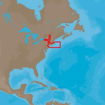
C-MAP NA-D940 4D Nautical Chart for Cape Cod, Long Island & Hudson River
The C-MAP 4D NA-940 is a detailed nautical chart covering the Cape Cod, Long Island and Hudson River areas. It provides comprehensive information on depth contours, navigation aids and other key features for safe navigation in these waters.
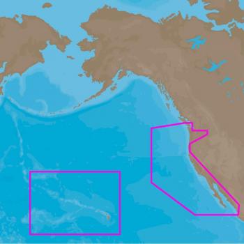
C-MAP 4D NA-D024 USA West Coast & Hawaii - Full Content
C-MAP 4D NA-D024 offers comprehensive coverage of the USA West Coast and Hawaii, including advanced features like 3D charts, satellite imagery, and real-time weather data.
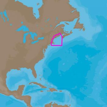
C-MAP NA-D939 4D Passamaquoddy Bay to Block Island
C-MAP 4D navigation chart for navigating between Passamaquoddy Bay and Block Island, providing detailed information on depths, hazards, and navigational aids.
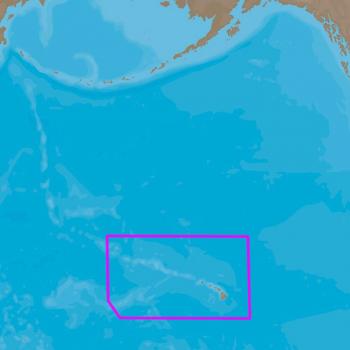
C-MAP NA-D963 4D Full Hawaiian Islands Local Chart
C-MAP 4D Full Hawaiian Islands Local Chart. Detailed, accurate, and up-to-date map of the Hawaiian Islands for navigation purposes, including depth contours and aerial photography. Suitable for marine use.
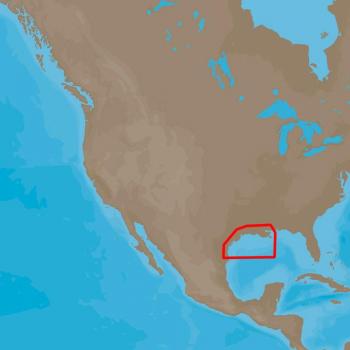
C-MAP NA-D945 4D Full New Orleans to Brownsville Local
C-MAP's 4D FULL New Orleans to Brownsville Local provides detailed coastal maps for navigation and fishing from New Orleans to Brownsville.
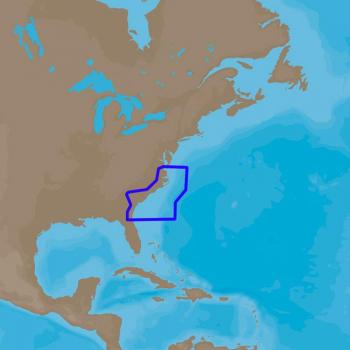
C-MAP NA-D942 4D Full Norfolk to Jacksonville Local
C-MAP 4D Navigation Chip for Norfolk to Jacksonville, includes detailed maps and local information.
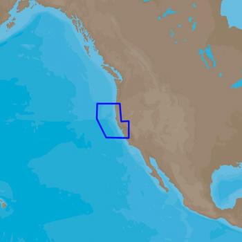
C-MAP NA-D953 4D Full Point Sur to Cape Blanco Local
C-MAP 4D Point Sur to Cape Blanco - NA-D953 is a detailed chart for the coastal area between Point Sur and Cape Blanco, providing accurate navigation information for local waters.
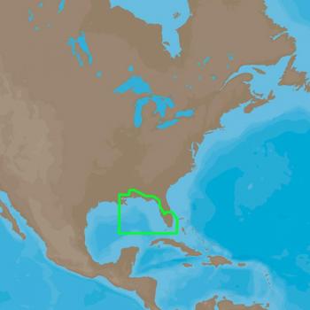
C-MAP NA-D944 4D Full St. Lucie Inlet to New Orleans Local
C-MAP 4D chart covers the area from St. Lucie Inlet to New Orleans, providing detailed local navigation information for boating enthusiasts.
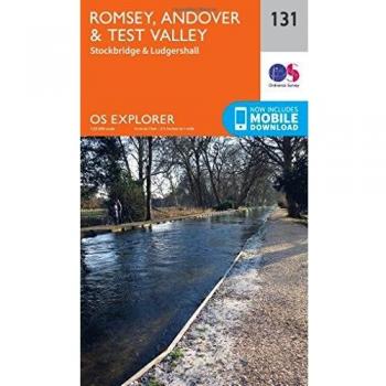
OS Explorer Map
Ordnance Survey (9780319243275) | OS Explorer
OS Explorer Map
Ordnance Survey (9780319246597) | OS Explorer
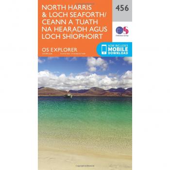
OS Explorer Map
Ordnance Survey (9780319246993) | Outdoor activities, North Harris
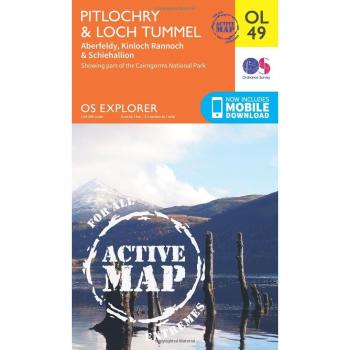
OS Explorer ACTIVE OL49 Pitlochry & Loch Tummel
Ordnance Survey (9780319469675) | OS Explorer, Horse riding and off-road

OS Explorer OL57 Cairn Gorm & Aviemore: Loch Morlich. Showing part of the Cairngorms National Park
Ordnance Survey (9780319242964) | OS Explorer

Dunkeld, Aberfeldy & Glen Almond Map | River Tay | Ordnance Survey | OS Explorer Map 379 | Scotland | Walks | Hiking | Maps | Adventure
Ordnance Survey (9780319246252 / 43226428) | OS Explorer, Outdoor activities